Geo Earth Mapping - Resource Mapping
Resource themed maps assist scientists, planners, technicians and the general public to identify and inventory existing resources, make informed decisions and develop strategic plans to achieve future goals compatible with the environment and community.
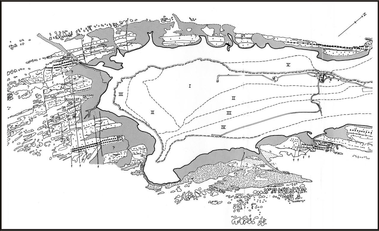
Geological Mapping
Geological Mapping involves the process of gathering geological data in the field along with GPS data and adding it to a topographic map base and often imagery to interpret and analyze the detail.Some geological applications involving GIS/Mapping include: site plans and profiles, surface and subsurface analysis, slope analysis and erosion control, mineral claim boundaries, geochemical & geophysical grid systems, road networks, borehole locations, diamond drill-hole locations, seismic activity, groundwater protection, sample site locations and bedrock mapping.
Surficial Geological Interpretation
Environmental / Ecological Mapping
GIS/Mapping initiatives are a step to ensure that the environment is taken into account from the earliest stages of planning. As a part of planning, they can assess the potential impacts on air, water, wetlands, endangered species, cultural resources, the social environment, and other resources. They also propose ways to lessen or eliminate the impacts through mitigation. Environmental Mapping includes the study of: Ecosystems, wildlife habitat areas, park, reserves and protected areas, fish habitats, stream assessments, lake survey results, wetlands studies, watershed analysis, preservation and restoration.
Projects Involving Environmental Impact Studies
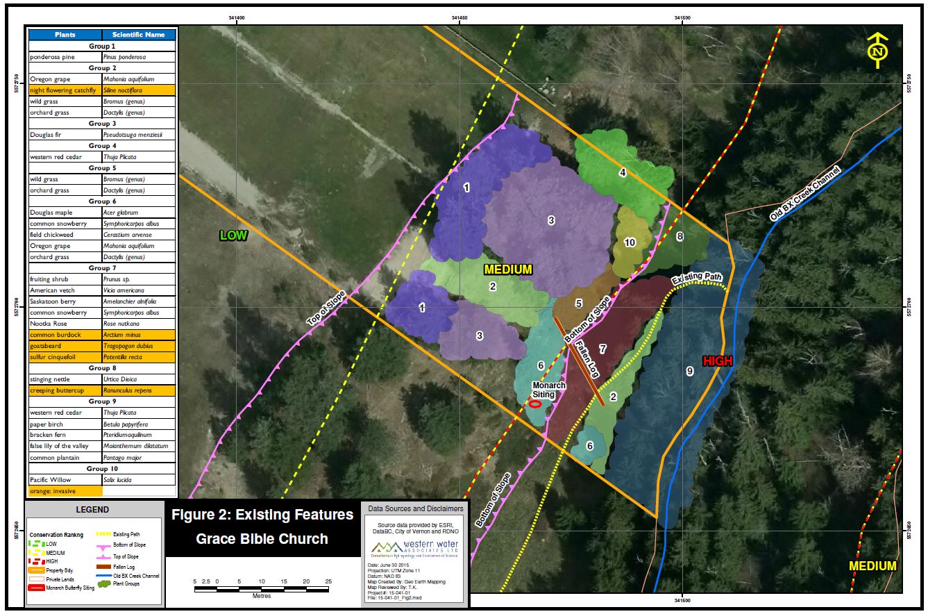
Sensitive Ecosystem Ranking

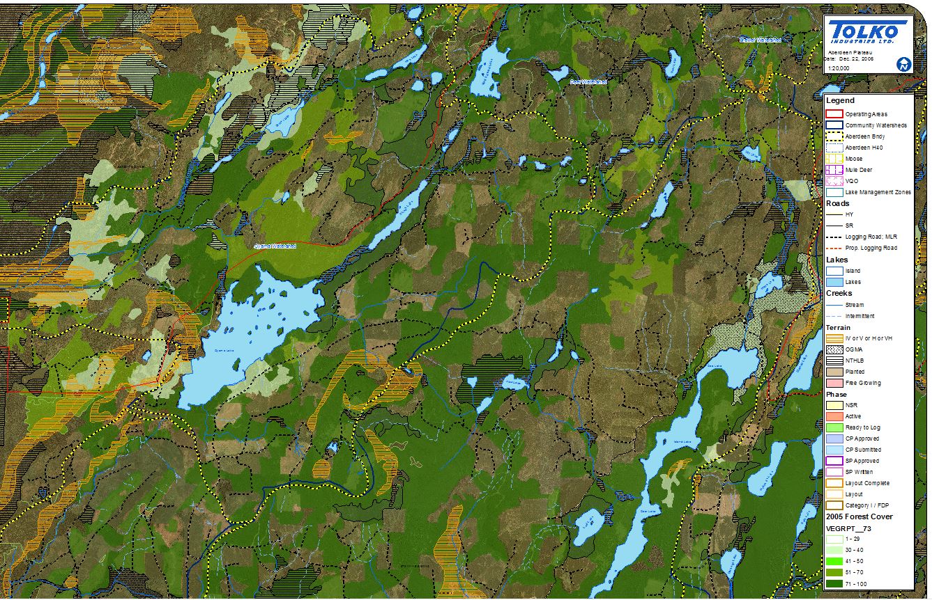
Forestry Mapping
The mapping components (spatial data) are integrated in the Forest Inventory DatabasePrograms, to carry out GIS Forest Inventory Mapping analysis to assist in monitoring future changes in this invaluable resource. VRI (forest cover) maps are joined with a forest data bases that contains information about the forest attributes such as species, age, height, crown-closure, etc...from which query analysis can take place. Other GIS/Mapping applications include: Pre-Harvest & post-harvest cut block traversing, road systems & landings, development plans, mechanical site preparation, juvenile spacing, mechanical brushing & planting, forest health, forest recreation and research plots.
Forest Development Plan